MALÅ Ground & Structural Radar Systems
Specializing in world leading MALÅ Ground & Structural GPR systems. Knowledge, expertise & experience we pride ourselves on. Based in Christchurch, we operate nationwide providing GPR instrumentation and solutions for multiple sectors and applications
Common Ground Penetrating Radar (GPR) Applications:
- Utilities: GPR can be used to locate and map the depth of water, gas, electric, communication lines, sanitary and storm sewers or unknown and abandoned pipes. GPR is also efficient for mapping the location of underground storage tanks and for pre-studies for horizontal directional drilling (HDD). Read More.
- Concrete investigation: GPR can be used to locate and map the depth of rebar’s and other installations in Concrete GPR is well suited, for instance, to map the thickness of concrete slabs/elements, void detection and concrete fracture mapping. Read More
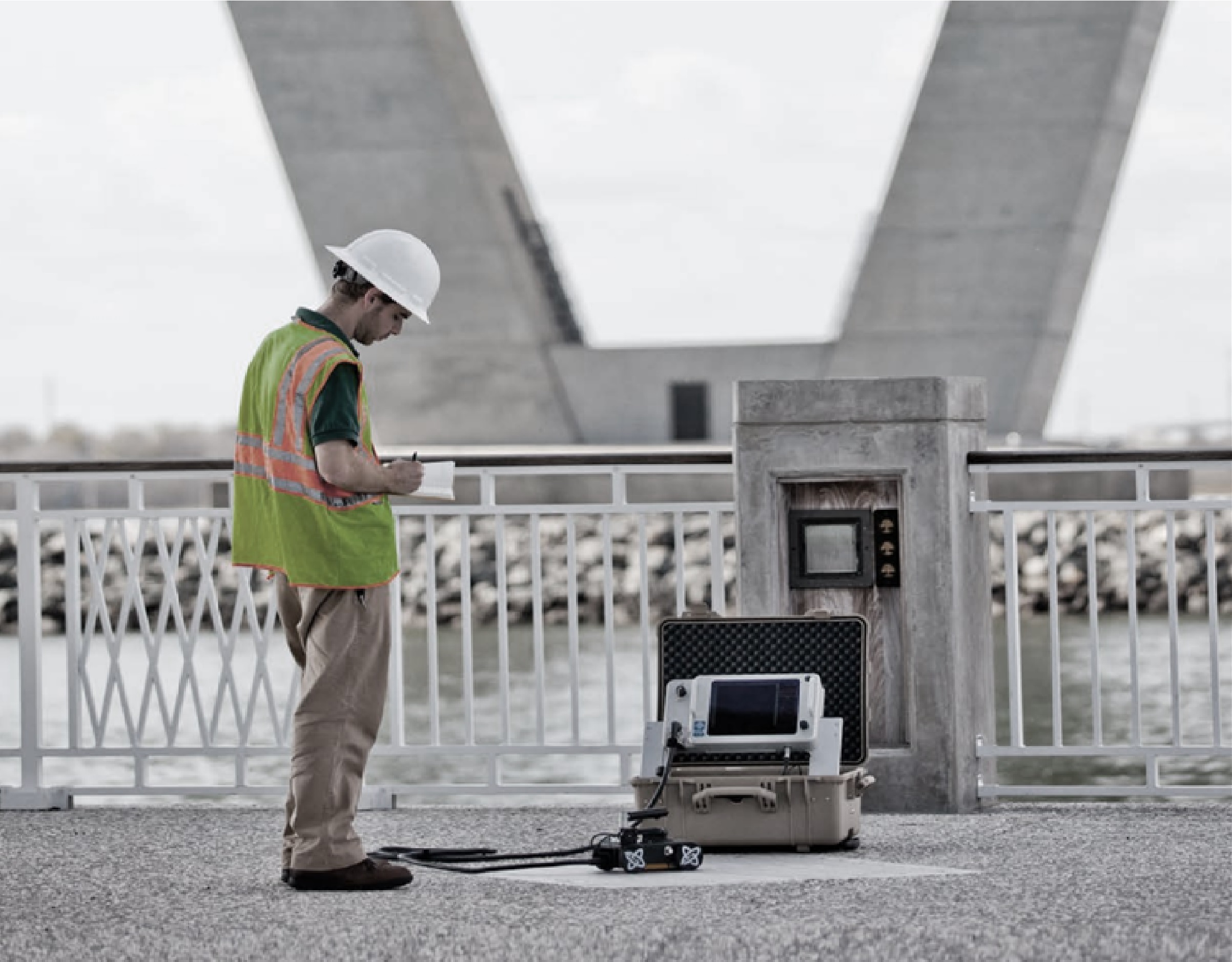
- Roads and Railways: GPR is widely used for mapping road and asphalt layering, as well as railroad ballast surveys. Further on GPR is suitable to investigate the internal structure of roads and railways and investigate the geological investigations prior to construction. GPR is also commonly used for bridge decks surveys and runway investigations at airports. Read More.
- Archaeology: GPR is often used to map archaeological landscapes, sites, features and objects.
- Geology: GPR can be used for stratigraphic mapping, structure analysis, cavity and sinkhole detection, depth to bedrock investigations, mapping of bedrock fractures, mining hazards etc.
- Water: GPR is well suited to map lakes and rivers, for bathymetry investigations as well as investigating the river and lake floor structures. GPR can also be used for geological investigations for the detection of ground water.
- Earth and concrete dams: GPR can be used to investigate the internal structure and layer of dams, as well as voids.
- Tunnels and Mining: GPR is used for fracture detection, structural investigations and concrete thickness evaluation. Read More.
- Environmental: GPR can aid in mapping hazardous waste, underground storage tanks and other utilities. Further on it is suitable to use a GPR to map the bedrock surface for estimating flow directions and also for lake sediment surveys. Read More.
- Military: GPR is often used for UXO (unexploded ordnance) detection, runway integrity analysis and clearing of trenching routes etc. Read More.
- Ice and Snow: GPR is an excellent tool for structure analysis of ice and snow, as well as ice and snow thickness estimations and crevasse detection etc.
Ground Penetrating Radar (GPR) is widely used in the geophysical, geotechnical, construction and infrastructure sectors. The ability to be able to identify buried assets within concrete or soil along with other key features of concrete structures or subsurface environments, completely non-destructively, allows for a more cost effective and time efficient solution to achieving the desired results.
Many tasks, which may have previously been, time consuming, costly, or simply not feasible can now be accomplished quickly and efficiently using GPR technology. This non-invasive technology produces enormous savings in construction, engineering, and maintenance worldwide.
Offering the broadest range of GPR products in the world, MALÅ delivers solutions for a wide range of applications including utility detection, road profiling, mineral exploration, archaeology, concrete investigations and many more.

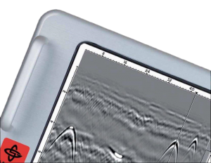
The world´s first intelligent Ground penetrating radar (GPR) solution.
MALÅ Easy Locator Core is the state of the art, intelligent ground penetrating radar solution for utility locating professionals.
MALÅ Easy Locator Core includes the best data quality on the market, real-time interpretation support through MALÅ AI; wireless data collection using mobile devices; cloud storage, post-processing and on-site reporting using MALÅ Vision.
All with the fastest workflow on the market.

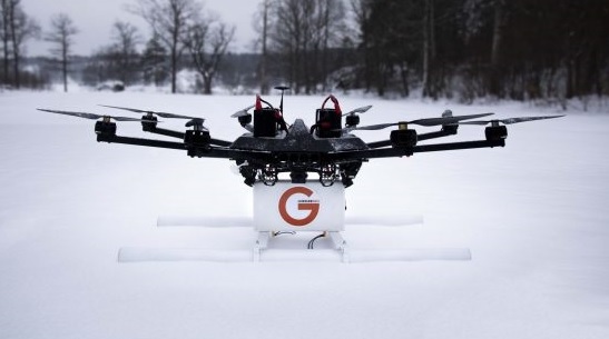
Airborne Ground Penetrating Radar.
The cutting edge solution for unmanned surveying.
3D GPR array for mapping out extensive areas.
MALÅ 3D Imaging Radar Array (MIRA) is a high-speed, one-pass 3D GPR system and the most effective solution for large-area GPR mapping.
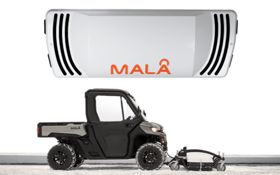
3D GPR array for mapping out extensive areas:
MALÅ 3D Imaging Radar Array (MIRA) is a high-speed, one-pass 3D GPR system and the most effective solution for small and large area GPR mapping.
(Page link currently under development, please contact us for further information in the interim).

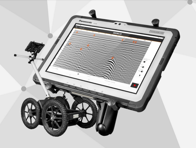
GPR Data acquisition on your mobile device
CONTACT US:
Telephone:
0800 47 77 65
Sales, Support and Rental Systems: sales@gprsolutions.co.nz
GPR Consulting Services: consulting@gprsolutions.co.nz
FOLLOW US:
Authorised reseller of MALA Ground Penetrating Radar systems throughout New Zealand
MEMBERS OF:
Accredited Supplier: National Utility Locating Contractors Association of Australia & New Zealand
IPENZ
Affiliate member of the Institution of Professional Engineers New Zealand
SCIRT
Accredited member of the Stronger Christchurch Infrastructure Rebuild Team
SITEWISE
SiteWise accredited Green 2019/2020
SIGN UP TO OUR NEWSLETTER
GPR Solutions Ltd – specialising in world leading MALA Ground Penetrating Radar systems for:
Rental / hire of GPR instruments, outright purchase, staff training, instrument servicing and support.
POSTAL ADDRESS:
12 Will Street
Rolleston
Canterbury 7614
New Zealand
GPR Solutions Limited | Company No: 5914576 | NZBN: 9429042238324